A history of GPS technology and how it relates to NZ: From Military Secret to Essential Kiwi Business Tool
Trace the evolution of GPS technology—from its military beginnings to the advanced navigation systems we rely on today. Discover how GPS reshaped communication, safety, and modern mobility.
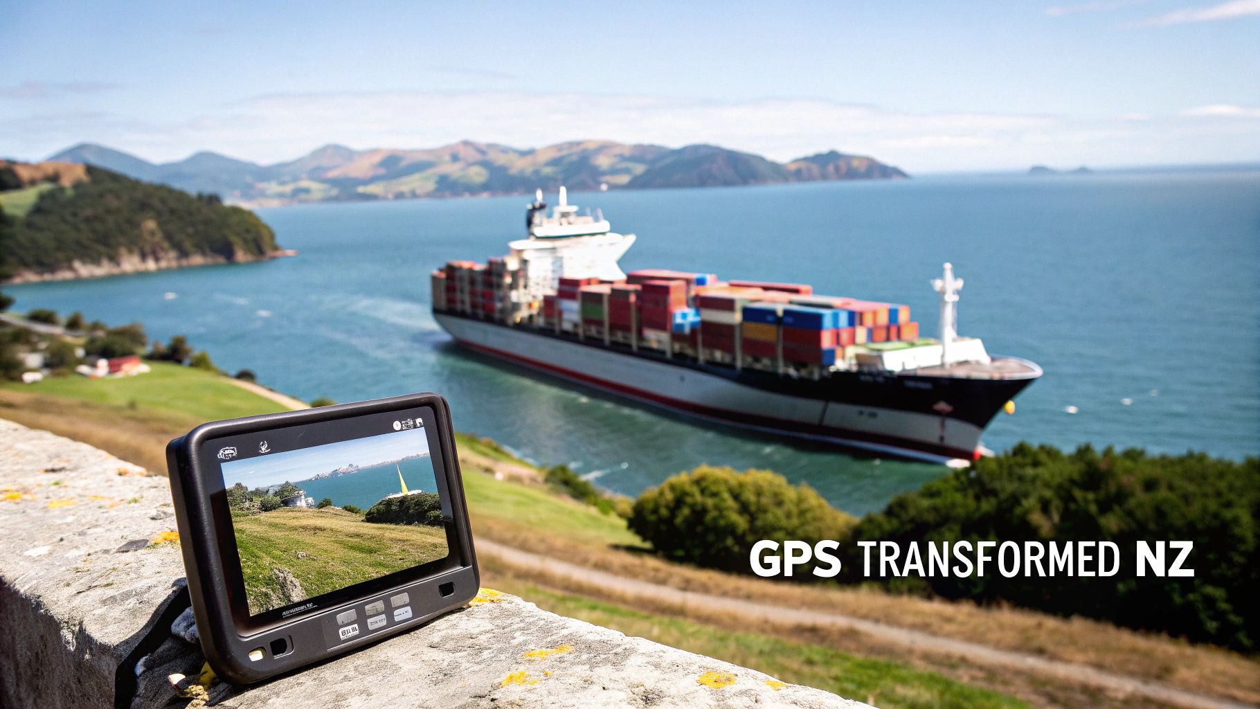
It's hard to imagine navigating the Cook Strait or managing a huge forestry operation with just paper maps. But not that long ago, that was the reality. The story of how GPS went from a classified military project to the absolute cornerstone of New Zealand's economy is a fascinating one. Are you leveraging its full potential to keep your teams safe and productive?
The journey of GPS is about more than just finding your way; it's about the seamless integration of location data into the communication tools that drive modern Kiwi businesses. How did a technology built for military advantage become so critical to our local landscape? This guide explores the history of GPS technology and how it relates to NZ, showing how it underpins the robust communication solutions offered by trusted providers like Tait, Hytera, Motorola, and Iridium.
The NZ Context: Why Precise Location is Mission-Critical
In a country defined by rugged terrain, isolated worksites, and a heavy reliance on primary industries, knowing exactly where your people and assets are is non-negotiable. From a high-country farm in Otago to a bustling construction site in Auckland, precise location data is fundamental for safety and success.
For New Zealand businesses across key sectors, the challenges are real:
- Agriculture & Forestry: Managing vast, remote areas and ensuring lone worker safety.
- Construction & Transport: Coordinating teams and fleets for maximum efficiency and meeting tight deadlines.
- Maritime & Fishing: Navigating unpredictable waters and having reliable emergency communications.
- Emergency Response: Dispatching the nearest unit when every second is critical.
These operational pain points are solved when you combine location awareness with reliable communication. It’s the fusion of GPS with devices like a walkie talkie NZ teams trust, a best UHF radio NZ-wide, or a satellite phone for true off-grid connectivity.
The Foundation of Modern Communication
GPS has become the essential partner to a huge range of communication devices. When a worker in a remote forestry block activates the man-down alert on their Tait or Motorola two-way radio, it's the built-in GPS that sends their exact coordinates, turning a simple distress call into a life-saving response.
Today, location awareness is simply a baseline requirement. For industries like transport, agriculture, and emergency services, the fusion of communication and GPS technology has set a new standard for operational intelligence and duty of care.
This guide will dive into the key milestones of GPS, its specific adoption here in New Zealand, and how it empowers the robust communication solutions we rely on.
The Dawn Of Satellite Navigation: A Global And Kiwi Perspective
The story of GPS begins not in a tech incubator, but during the Cold War with a US military project called NAVSTAR. The goal was ambitious: create a system to provide military forces with precise location and timing information, anywhere on Earth. For years, this was strictly for military use, but a global tragedy forced a change that would benefit the world.
A Global Tragedy Opens The Door
The turning point was in 1983 when Korean Air Lines Flight 007 was shot down after straying into Soviet airspace. This catastrophe highlighted the urgent need for better civilian navigation. In response, U.S. President Ronald Reagan made the landmark decision to grant civilian access to GPS signals.
This move kicked off a new era of innovation. By 1995, a constellation of 24 satellites was fully operational, providing global coverage. The stage was set for a wave of technology that would soon reach New Zealand’s shores. You can learn more about the critical events that shaped GPS accessibility here.
New Zealand's First Steps Into A New Era
While the satellites orbited above, the impact was felt right here in Aotearoa. In 1986, a quiet revolution took place in the rugged wilderness of Fiordland. For the first time, a survey was conducted in New Zealand using GPS. This marked the beginning of the end for painstaking manual measurements and peering through a theodolite.
That first survey was a fundamental shift. It proved that this new satellite technology could conquer the tyranny of distance and terrain that defines so much of New Zealand, paving the way for its use across countless industries.
The Game-Changer: Selective Availability Is Switched Off
For years, civilian GPS users faced a major hurdle. The U.S. military deliberately degraded the public signal's accuracy using a feature called 'Selective Availability' (SA). This meant that while the military had pinpoint precision, the rest of us were stuck with an accuracy of around 100 metres—too coarse for serious commercial applications.
Then, on 1 May 2000, everything changed. The White House ordered Selective Availability to be switched off, permanently.
Overnight, accuracy for civilian GPS users improved tenfold to within about 10 metres. This single act unlocked a tidal wave of commercial innovation. Suddenly, GPS became a viable tool for applications demanding real precision. This was the true beginning of the GPS boom in New Zealand, sparking development in everything from fleet management and precision agriculture to lone worker safety and marine navigation with the best VHF marine radio NZ could offer.
How GPS And GNSS Technology Actually Work
At its heart, GPS is a precise conversation happening at the speed of light. The system works on a principle called trilateration. Your device on the ground isn't transmitting; it's a sophisticated listener. It tunes into signals broadcast by multiple satellites, each stamped with the exact time it was sent. By locking onto signals from at least four satellites, your device can calculate its precise position—longitude, latitude, and altitude.
The Three Segments Of The GPS System
- The Space Segment: This is the constellation of about 31 operational satellites in the US GPS system. They continuously broadcast their position and hyper-accurate time from onboard atomic clocks.
- The Control Segment: A network of ground stations monitors the satellites, tracking their orbits and syncing their clocks to ensure the data they broadcast is unfailingly accurate.
- The User Segment: This is your device. It could be a satellite phone, a dedicated GPS tracker on forestry equipment, or the UHF radio in your vehicle. The receiver interprets the satellite signals to calculate your exact spot on the map.
This simple diagram shows the flow from military-controlled satellites to widespread civilian use in New Zealand.
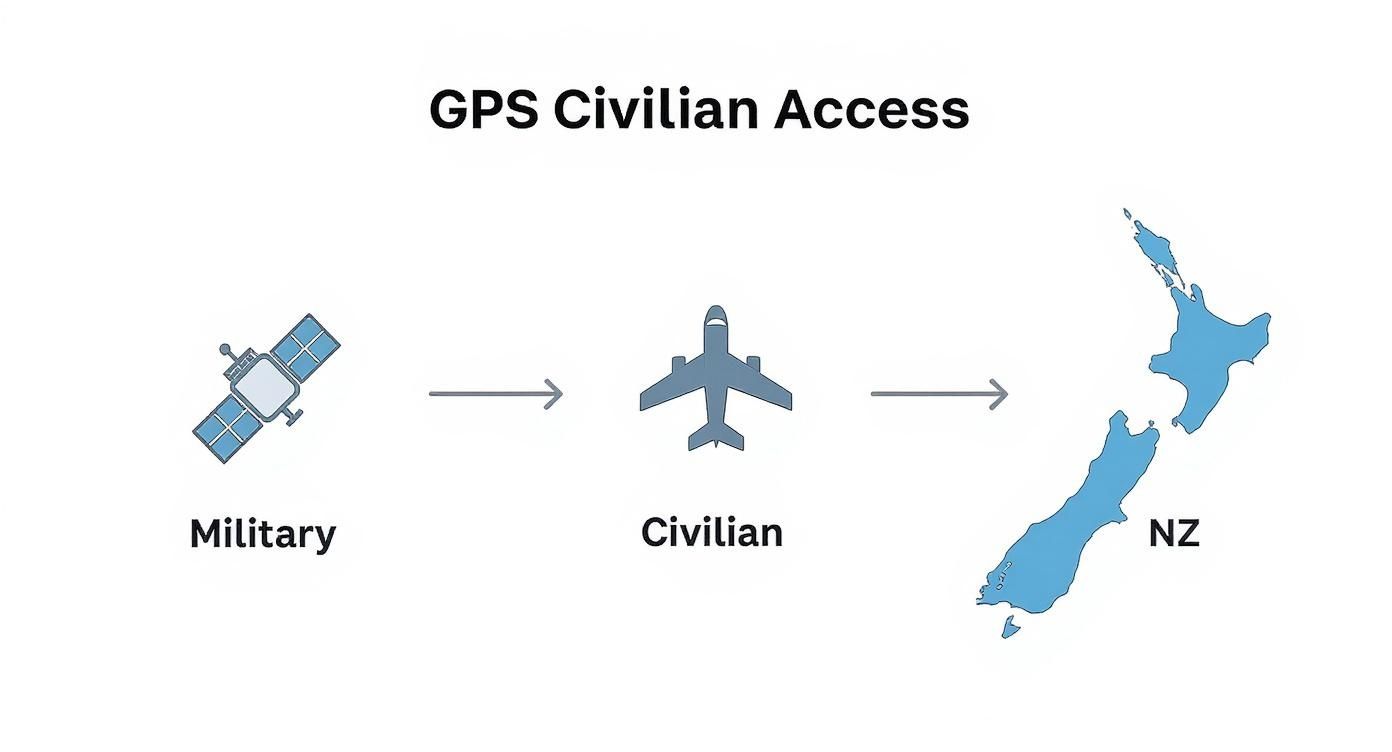
This visualisation captures the critical shift that made GPS a universal tool, underpinning countless industries across New Zealand today.
What Affects GPS Accuracy
While incredibly reliable, several factors can affect precision. Atmospheric conditions can slightly delay the signal, creating small errors. A bigger issue in NZ is signal multipath, where signals bounce off buildings, cliffs, or dense forest canopies before reaching your device. This is why GPS can struggle in CBDs or deep valleys. For a deeper technical dive, you can learn more about how GPS works on our blog. To really get to grips with the mechanics, it’s worth digging into topics like understanding the intricacies of GPS satellite connectivity for drone operations.
New Zealand's Journey to Centimetre-Level Precision
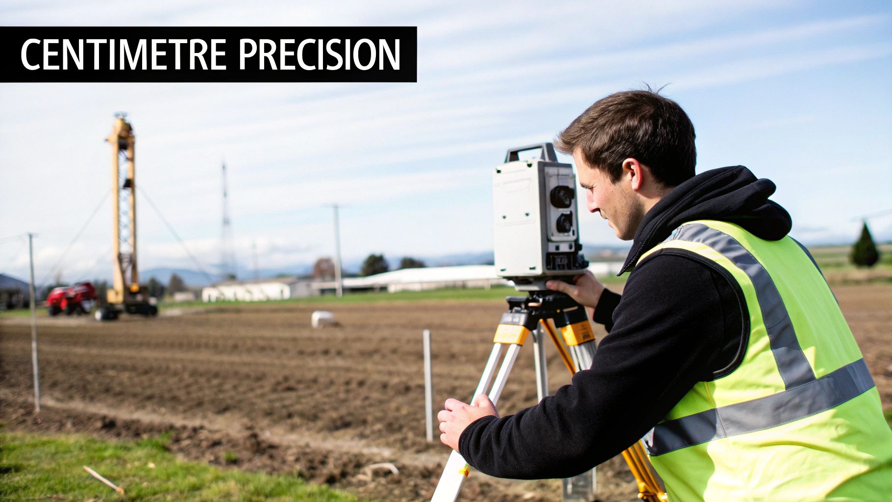
For many of New Zealand’s most demanding industries, standard 5–10 metre GPS accuracy doesn't cut it. When grading a construction site or planting crops, every centimetre matters. This demand drove the adoption of advanced technologies that took our positioning capabilities from a rough guide to an absolute certainty.
Since that first GPS survey in 1986, systems like Satellite-Based Augmentation Systems (SBAS) and Real-Time Kinematic (RTK) have completely changed the game, refining location data down to just centimetres. This has modernised key sectors like agriculture, construction, and maritime operations. Learn more about New Zealand's pioneering role in navigation technology.
SBAS: The Continental Fact-Checker
Think of a Satellite-Based Augmentation System (SBAS) as a real-time fact-checking service for GPS signals. A network of ground stations measures GPS signal accuracy, spots any atmospheric distortions, and sends this correction data up to a geostationary satellite. That satellite then broadcasts the correction message down, covering an entire region. Any SBAS-enabled receiver can use this to refine its position, which is vital for aviation and maritime safety.
RTK: Bringing Precision Down to Earth
While SBAS improves accuracy over a wide area, Real-Time Kinematic (RTK) positioning takes precision to a new level on a local scale. RTK uses a fixed ‘base station’ at a known, surveyed point. This base station compares its fixed position with the satellite data, identifies tiny errors, and broadcasts a real-time correction signal via a radio link to nearby ‘rover’ units (like the GPS on a tractor). The rover uses this local correction to calculate its position with extraordinary precision.
RTK is the difference between knowing which part of a paddock a tractor is in and knowing exactly which row of crops it's driving down. It is the engine of modern precision operations.
Evolution of GPS Accuracy in New Zealand
This table illustrates the progression of GPS accuracy available to civilian users in New Zealand.
| Era | Approximate Accuracy | Key Enabling Technology/Event |
|---|---|---|
| Early 1990s | 100 metres | Selective Availability (SA) active |
| 2000 | 5–10 metres | Selective Availability (SA) turned off |
| Mid-2000s | 1–2 metres | Widespread adoption of SBAS-capable receivers |
| Late 2000s onwards | 1–2 centimetres | Commercial and national RTK networks (like PositioNZ) become accessible |
The Role of PositioNZ
New Zealand has invested heavily in the infrastructure needed for high-precision technology. The backbone is the PositioNZ network, managed by Toitū Te Whenua Land Information New Zealand (LINZ). PositioNZ is a country-wide network of GNSS reference stations that provide the high-quality data for RTK services, allowing surveyors, contractors, and farmers to achieve vital centimetre-level results.
GPS In Action: Transforming Key New Zealand Industries
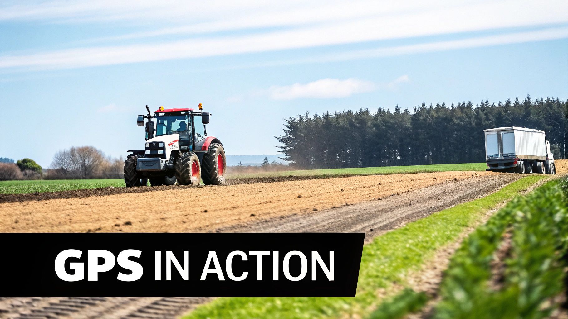
The real story of GPS in New Zealand is how it gets put to work on our farms, on our waters, and across our most challenging worksites. It’s now the unseen hero powering efficiency and safety in the sectors that form the backbone of our economy.
Agriculture and Forestry
In the Waikato or Canterbury Plains, precision agriculture is standard practice. GPS-guided tractors plant seeds, apply fertiliser, and spray crops with centimetre-level accuracy.
This precision brings serious benefits:
- Reduced Waste: Less overuse of expensive chemicals and fertilisers.
- Increased Yields: Optimising every square metre of land for productivity.
- Enhanced Efficiency: Operations can run 24/7, even in low-visibility conditions.
In our sprawling forestry blocks, GPS is critical for mapping, harvest planning, and worker safety. Knowing the exact location of every crew member and machine in remote, coverage-poor terrain is fundamental. Pairing this with a reliable UHF CB radio NZ forestry teams use ensures both location and voice are covered.
Transport, Logistics, and Fleet Management
For New Zealand's transport industry, GPS tracking has been a game-changer. It’s the core technology that lets fleet managers see their entire operation, optimising routes, monitoring driver behaviour, and ensuring timely deliveries. This detailed oversight helps businesses slash fuel costs and improve maintenance schedules. See real-world examples in case studies on geofencing for fleet management.
GPS tracking is the central nervous system of modern logistics. It provides the real-time data needed to make smarter, faster, and safer decisions.
Emergency Services and Maritime Safety
When lives are on the line, precise location is everything. For our emergency services, GPS enables a faster, more effective response by dispatching the closest unit to an incident.
In the maritime world, GPS is vital for navigation and powers critical safety systems like Emergency Position-Indicating Radio Beacons (EPIRBs), which transmit a vessel's exact coordinates to rescue services. Leading brands like GME and Oceansignal are trusted for this life-saving technology. For a closer look at how GPS guides modern communication tools, check our guide on finding your way with GPS.
Choosing a Partner for Your GPS and Communication Needs
Knowing the tech is one thing, but deploying a reliable GPS and communication solution that delivers on safety and efficiency requires a partner with deep, local knowledge. This is where specialist providers outshine large department stores, which often have a limited range and lack deep product knowledge.
A good partner works with you to understand the unique challenges of your business, from navigating rough forestry terrain to managing a nationwide logistics fleet.
The Mobile Systems Difference: NZ Owned and Operated
We’re not just another supplier; we're a dedicated communications partner. As a 100% NZ-owned company based in Mt Maunganui, we’ve helped Kiwi businesses solve their communication challenges for nearly two decades. Our expertise is earned through years of hands-on fieldwork with businesses just like yours. We don't just sell boxes; we provide complete, field-tested solutions from world-class brands like Tait, Hytera, Starlink, Motorola, Entel, GME, Uniden, Iridium, and Cel-Fi.
Our commitment to you includes:
- A mobile on-site support fleet that comes directly to you.
- Expert device programming and custom installations.
- Proper servicing and maintenance plans to keep you running.
Your End-to-End Solution Provider
Implementing new tech is more than plugging in hardware. We handle the tricky stuff, like sorting Radio Spectrum Management (RSM) licensing and designing custom coverage plans. Our focus is on long-term reliability and aftercare, ensuring your investment pays off for years.
From lone worker safety systems to advanced fleet management, our solutions are built for tough New Zealand conditions. See how these tools work in practice in our article on the modern GPS tracker.
Choosing a partner means choosing a long-term relationship built on trust, technical expertise, and local understanding.
When you work with us, you’re investing in a solid, reliable solution backed by a team of New Zealand-based experts dedicated to keeping your people connected and your operations moving.
Got Questions? We've Got Answers
Here are some common questions we get from businesses across New Zealand about GPS, tracking, and getting the right setup.
What's the Difference Between GPS and GNSS?
GPS (Global Positioning System) was the original US system, and the name stuck. The more accurate term today is GNSS (Global Navigation Satellite System), which includes other global systems like Russia's GLONASS, Europe's Galileo, and China's BeiDou.
Modern, professional-grade receivers are multi-GNSS. This is a huge advantage in New Zealand, as the device can use satellites from multiple constellations at once, boosting accuracy and reliability, especially in tricky spots like urban centres or deep valleys.
Do I Need a Licence to Use GPS Tracking for My Business in NZ?
You don't need a specific licence for the GPS function itself, but you MUST comply with New Zealand's Privacy Act. You cannot simply install trackers and monitor your team without having a clear policy in place.
It is critical to have:
- A formal, written company vehicle GPS tracking policy.
- A legitimate business reason for tracking (e.g., safety, asset security).
- A process to ensure every employee has been informed about the policy and has acknowledged it.
If your GPS is part of a communication device like a UHF/VHF radio, you will almost certainly need a radio licence from Radio Spectrum Management (RSM). A specialist partner like Mobile Systems can guide you through both privacy obligations and RSM licensing.
How Accurate is GPS in Rural New Zealand?
In open rural areas, standard GPS provides 5-10 metre accuracy. This is great for general navigation but can degrade under thick forest canopy or in steep valleys.
For jobs needing pinpoint precision—like modern farming or construction—you need technology like RTK (Real-Time Kinematic). Using a local base station or a national correction network like PositioNZ, RTK can achieve incredible centimetre-level accuracy. To keep these high-tech systems connected in remote areas, they are often paired with rugged satellite communication solutions like Iridium or satellite internet NZ providers offer, such as Starlink.
What's the Best Solution for Lone Worker Safety?
A simple dot on a map is not enough. The best lone worker solutions combine reliable GPS tracking, dedicated safety features, and dependable two-way communication.
Devices like the Motorola TLK110 or specialised satellite messengers are excellent options. Look for these key features:
- A dedicated SOS button for immediate alerts.
- 'Man down' or 'no-motion' sensors that automatically trigger an alarm.
- Real-time location tracking for an exact position.
Ultimately, the choice between a cellular-based radio or a satellite device depends on one question: where does your team work? Inside or outside of mobile coverage? Getting that right ensures you can find and talk to your people in any emergency.
Ready to put a reliable, high-performance GPS and communication solution to work for your team? The experts at Mobile Systems Limited can design a system that fits your operation perfectly, boosting safety and efficiency across your business.
Related posts

- May 27, 2026
Discover Freedom Internet NZ solutions. Explore reliable connectivity like Starlink for your NZ business or remote teams.

- May 25, 2026
Find your ideal satellite dish NZ solution for business. Our 2026 guide covers types, installation, and choosing the right system...

- May 20, 2026
Unlock the power of 5G wireless broadband NZ for your business. Our guide covers coverage, FWA vs mobile, equipment, and...